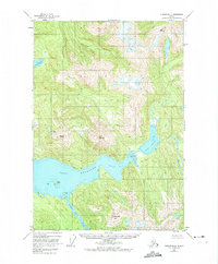
1948 Map of Sumdum B-4
USGS Topo · Published 1974About this map
Washington Peak towers over a complex landscape of glacial inlets and tidal waterways in this mid-century survey of the Tongass National Forest. The map is dominated by the expansive Port Houghton and its North Arm, where the topography transitions sharply from high alpine ridges down to a sprawling Tidal Flat. A solitary Cabin on Walter Island represents the only named man-made structure in this coastal wilderness, suggesting the isolated nature of the area's early human footprint.
Find a feature on this map
14 named features on this map. Tap any name to fly to it.
Don’t see what you’re looking for? This feature index may not catch every label — zoom into the map to look around manually.
Map Details
Editions of this 1948 Sumdum B-4 Map
2 editions found
Other maps of this area

1943 · Sumdum B-4
USGS Topo · 1:63,360

1948 · Sumdum A-4
USGS Topo · 1:63,360

1948 · Sumdum A-5
USGS Topo · 1:63,360

1948 · Sumdum C-5
USGS Topo · 1:63,360

1948 · Sumdum B-5
USGS Topo · 1:63,360

1948 · Sumdum B-4
USGS Topo · 1:63,360

1951 · Sumdum C-5
USGS Topo · 1:63,360

1951 · Sumdum A-4
USGS Topo · 1:63,360

1951 · Sumdum B-5
USGS Topo · 1:63,360

1952 · Sumdum
USGS Topo · 1:250,000