
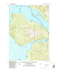
1951 Map of Sumdum C-5
USGS Topo · Published 1963About this map
Windham Bay serves as the focal point for coastal activity on this mid-century survey, anchoring a landscape shaped by tidal flats and mining interests. The presence of the Windham PO at the head of the bay, along with the Chuck Mining Camp situated nearby along the Chuck River, indicates a period of persistent resource extraction within the Tongass National Forest. Navigation through The Narrows connects these inland reaches to the open waters of Stephens Passage. This area, which includes the significant landmass of Sumdum Island in Endicott Arm, reflects a rugged maritime economy where transit relied heavily on sheltered coves like Sanford Cove and named landmarks such as Pt Windham. Several cabins and a single Mine label further attest to the sparse but deliberate human footprint in this Alaskan wilderness.
Find a feature on this map
37 named features on this map. Tap any name to fly to it.
Don’t see what you’re looking for? This feature index may not catch every label — zoom into the map to look around manually.
Map Details
Editions of this 1951 Sumdum C-5 Map
2 editions found
Other maps of this area

1943 · Sumdum B-4
USGS Topo · 1:63,360

1948 · Sumdum D-6
USGS Topo · 1:63,360

1948 · Sumdum C-5
USGS Topo · 1:63,360

1948 · Sumdum B-6
USGS Topo · 1:63,360

1948 · Sumdum C-6
USGS Topo · 1:63,360

1948 · Sumdum B-5
USGS Topo · 1:63,360

1948 · Sumdum D-5
USGS Topo · 1:63,360

1948 · Sumdum B-4
USGS Topo · 1:63,360

1951 · Sumdum D-6
USGS Topo · 1:63,360

1951 · Sumdum B-5
USGS Topo · 1:63,360