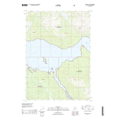
2017 Map of Sumdum B-4 SW
USGS Topo · Published 2017About this map
Tongass National Forest dominates this coastal Alaskan landscape, where the dramatic rise of the Coast Mountains meets the intricate waterways of the Alexander Archipelago. The survey centers on the deep, glaciated waters of Port Houghton and its secondary branch, North Arm Port Houghton. These marine passages are characteristic of the region's steep fjords, providing natural corridors through the heavily timbered interior. Isolated peaks and high-elevation waters like Alice Lake illustrate the transition from sea level to the high ridges of the Unorganized Borough.
Find a feature on this map
12 named features on this map. Tap any name to fly to it.
Don’t see what you’re looking for? This feature index may not catch every label — zoom into the map to look around manually.
Map Details
Editions of this 2017 Sumdum B-4 SW Map
This is the sole edition of this map. No revisions or reprints were ever made.
Other maps of this area

1943 · Sumdum B-4
USGS Topo · 1:63,360

1948 · Sumdum A-4
USGS Topo · 1:63,360

1948 · Sumdum A-5
USGS Topo · 1:63,360

1948 · Sumdum B-5
USGS Topo · 1:63,360

1948 · Sumdum B-4
USGS Topo · 1:63,360

1951 · Sumdum A-4
USGS Topo · 1:63,360

1951 · Sumdum B-5
USGS Topo · 1:63,360

1952 · Sumdum
USGS Topo · 1:250,000

1961 · Sumdum
USGS Topo · 1:250,000

1996 · Sumdum B-4
USGS Topo · 1:63,360