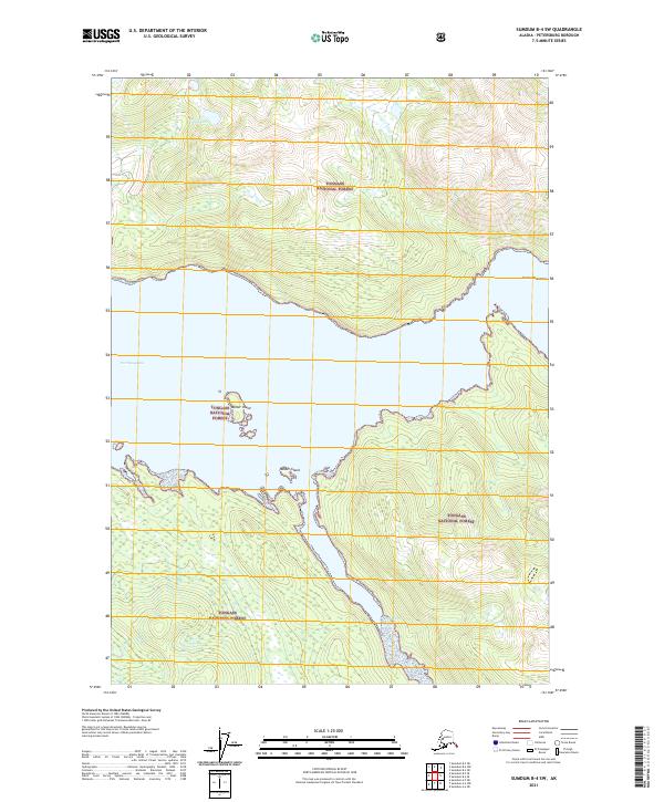
2021 Map of Sumdum B-4 SW
USGS Topo · Published 2021About this map
Tongass National Forest dominates this Alaskan coastal reach, where the steep terrain of the Coast Mountains meets the tidal waters of Port Houghton. This modern survey reveals a landscape defined by sharp vertical relief and complex glacial hydrography, notably around the elevated Alice Lake in the northern portion of the quadrangle. The map details the intricate shoreline and several offshore landmasses, including Walter Island and Rabbit Island, which sit at the mouth of the bay. The lack of roads or established settlements emphasizes the remote wilderness character of this region, which remains largely under federal management within the National Forest system. Researchers and cartography enthusiasts can study the precise elevation contours and wetland distributions that characterize this rugged portion of the Petersburg Borough.
Find a feature on this map
10 named features on this map. Tap any name to fly to it.
Don’t see what you’re looking for? This feature index may not catch every label — zoom into the map to look around manually.
Map Details
Editions of this 2021 Sumdum B-4 SW Map
This is the sole edition of this map. No revisions or reprints were ever made.
Other maps of this area

1943 · Sumdum B-4
USGS Topo · 1:63,360

1948 · Sumdum A-4
USGS Topo · 1:63,360

1948 · Sumdum A-5
USGS Topo · 1:63,360

1948 · Sumdum B-5
USGS Topo · 1:63,360

1948 · Sumdum B-4
USGS Topo · 1:63,360

1951 · Sumdum A-4
USGS Topo · 1:63,360

1951 · Sumdum B-5
USGS Topo · 1:63,360

1952 · Sumdum
USGS Topo · 1:250,000

1961 · Sumdum
USGS Topo · 1:250,000

1996 · Sumdum B-4
USGS Topo · 1:63,360