
1951 Map of Sumdum B-5
USGS Topo · Published 1974About this map
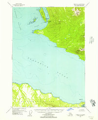
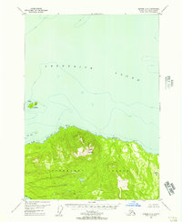
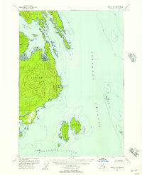
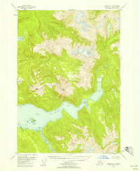
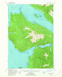
Stephens Passage dominates the western reaches of this 1950s coastal survey, serving as a vital maritime artery for Southeast Alaska. Along the shoreline, isolated human activity is evident at Sunset Cove, which features a CAA Relay Station and several Cabins. The interior landscape is defined by the high peaks of the Fanshaw Range, where economic interests are marked by the K and D Mine near Libby Creek and a Placer Mine further south. Maritime safety and navigation are anchored by the Five Finger Lighthouse positioned among The Five Fingers islands. The deep inlets of Hobart Bay and Port Houghton carve into the mainland, revealing a network of smaller islands such as the Robert Islands and Entrance I, while Salt Chuck indicates the specialized tidal environments of the Alexander Archipelago.
Find a feature on this map
34 named features on this map. Tap any name to fly to it.
Don’t see what you’re looking for? This feature index may not catch every label — zoom into the map to look around manually.
Map Details
Editions of this 1951 Sumdum B-5 Map
This is the sole edition of this map. No revisions or reprints were ever made.
Other maps of this area

1943 · Sumdum B-4
USGS Topo · 1:63,360

1948 · Sumdum A-4
USGS Topo · 1:63,360
1948 · Sumdum A-5
USGS Topo · 1:63,360

1948 · Sumdum C-5
USGS Topo · 1:63,360
1948 · Sumdum A-6
USGS Topo · 1:63,360
1948 · Sumdum B-6
USGS Topo · 1:63,360

1948 · Sumdum C-6
USGS Topo · 1:63,360

1948 · Sumdum B-5
USGS Topo · 1:63,360
1948 · Sumdum B-4
USGS Topo · 1:63,360
1951 · Sumdum C-5
USGS Topo · 1:63,360