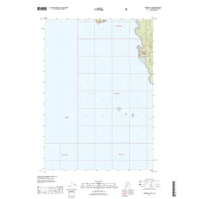
2017 Map of Sumdum B-5 NW
USGS Topo · Published 2017About this map
Stephens Passage dominates this maritime survey, revealing the remote coastal interface of Southeast Alaska. The map traces the western edge of the Tongass National Forest, where steep, forested terrain meets the tidal waters of the Alexander Archipelago. Coastal features such as Sunset Cove and Rocky Point provide critical landmarks for navigation along the jagged shoreline. Further offshore, isolated hazards and landforms including McDonald Rock, The Twins, and Sunset Island emerge from the deep waters. This map is primarily an examination of the untouched wilderness and nautical geography of the Petersburg Borough, where the lack of roads or settlements underscores the region's reliance on waterborne travel and the vast scale of the national forest system.
Find a feature on this map
11 named features on this map. Tap any name to fly to it.
Don’t see what you’re looking for? This feature index may not catch every label — zoom into the map to look around manually.
Map Details
Editions of this 2017 Sumdum B-5 NW Map
This is the sole edition of this map. No revisions or reprints were ever made.
Other maps of this area

1948 · Sumdum C-5
USGS Topo · 1:63,360

1948 · Sumdum B-6
USGS Topo · 1:63,360

1948 · Sumdum C-6
USGS Topo · 1:63,360

1948 · Sumdum B-5
USGS Topo · 1:63,360

1951 · Sumdum C-5
USGS Topo · 1:63,360

1951 · Sumdum B-5
USGS Topo · 1:63,360

1951 · Sumdum C-6
USGS Topo · 1:63,360

1952 · Sumdum
USGS Topo · 1:250,000

1961 · Sumdum
USGS Topo · 1:250,000
1996 · Sumdum B-5
USGS Topo · 1:63,360