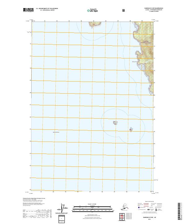
2021 Map of Sumdum B-5 NW
USGS Topo · Published 2021About this map
Tongass National Forest dominates the eastern coastline of this maritime Alaskan landscape, where the dense timber of the national forest meets the waters of the Inside Passage. Along the shore, Sunset Cove provides a natural harbor, flanked to the south by the prominent reach of Rocky Point. The drainage of Libby Cr cuts through the forest slopes, contributing to the complex hydrography of the borough. Navigation in these waters requires attention to submerged and semi-submerged hazards like McDonald Rock and the small outcroppings known as The Twins. This 2021 survey illustrates the interface between the protected federal lands of the TNF and the intricate coastal geometry of the Petersburg Borough.
Find a feature on this map
11 named features on this map. Tap any name to fly to it.
Don’t see what you’re looking for? This feature index may not catch every label — zoom into the map to look around manually.
Map Details
Editions of this 2021 Sumdum B-5 NW Map
This is the sole edition of this map. No revisions or reprints were ever made.
Other maps of this area

1948 · Sumdum C-5
USGS Topo · 1:63,360

1948 · Sumdum B-6
USGS Topo · 1:63,360

1948 · Sumdum C-6
USGS Topo · 1:63,360

1948 · Sumdum B-5
USGS Topo · 1:63,360

1951 · Sumdum C-5
USGS Topo · 1:63,360

1951 · Sumdum B-5
USGS Topo · 1:63,360

1951 · Sumdum C-6
USGS Topo · 1:63,360

1952 · Sumdum
USGS Topo · 1:250,000

1961 · Sumdum
USGS Topo · 1:250,000
1996 · Sumdum B-5
USGS Topo · 1:63,360