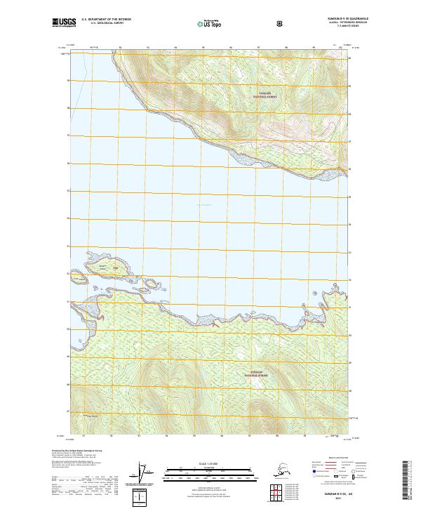
2021 Map of Sumdum B-5 SE
USGS Topo · Published 2021About this map
Port Houghton dominates the central landscape of this Southeast Alaska coastal region, where tidal waters meet the steep elevations of the Tongass National Forest. The map provides a detailed look at the interface between the marine and mountainous environments, including the distinct formations of The Haystack and the lower reaches of the Fanshaw Range. These features reflect the complex glacially-carved topography typical of the Alexander Archipelago. Coastal navigation and local geography are further detailed through named points and inlets such as Russian Cove and the small landmasses of Robert Island and Crow Island. The drainage of Negro Cr illustrates the typical short, high-gradient watercourses that characterize this wilderness area, flowing from the high timberline directly into the sea.
Find a feature on this map
12 named features on this map. Tap any name to fly to it.
Don’t see what you’re looking for? This feature index may not catch every label — zoom into the map to look around manually.
Map Details
Editions of this 2021 Sumdum B-5 SE Map
This is the sole edition of this map. No revisions or reprints were ever made.
Other maps of this area

1943 · Sumdum B-4
USGS Topo · 1:63,360

1948 · Sumdum A-4
USGS Topo · 1:63,360

1948 · Sumdum A-5
USGS Topo · 1:63,360

1948 · Sumdum B-5
USGS Topo · 1:63,360

1948 · Sumdum B-4
USGS Topo · 1:63,360

1951 · Sumdum A-4
USGS Topo · 1:63,360

1951 · Sumdum B-5
USGS Topo · 1:63,360

1952 · Sumdum
USGS Topo · 1:250,000

1961 · Sumdum
USGS Topo · 1:250,000

1996 · Sumdum B-4
USGS Topo · 1:63,360