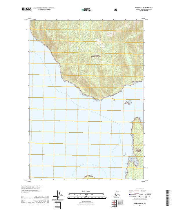
2021 Map of Sumdum C-5 SW
USGS Topo · Published 2021About this map
Tongass National Forest dominates this coastal Alaskan landscape, where the steep, forested slopes of the mainland meet the waters of the Inside Passage. The prominent Point Windham serves as a geographic anchor at the tip of a southern peninsula, marking a significant transition in the shoreline. Off the coast to the south, Sunset Island sits isolated in the open water, while another narrow landmass to the east features dense wetlands and further forest cover. This survey illustrates the primitive and undeveloped nature of the Alexander Archipelago, showing a landscape defined almost entirely by its elevation contours and natural maritime boundaries rather than human settlement or infrastructure.
Find a feature on this map
7 named features on this map. Tap any name to fly to it.
Don’t see what you’re looking for? This feature index may not catch every label — zoom into the map to look around manually.
Map Details
Editions of this 2021 Sumdum C-5 SW Map
This is the sole edition of this map. No revisions or reprints were ever made.
Other maps of this area

1948 · Sumdum C-5
USGS Topo · 1:63,360

1948 · Sumdum B-6
USGS Topo · 1:63,360

1948 · Sumdum C-6
USGS Topo · 1:63,360

1948 · Sumdum B-5
USGS Topo · 1:63,360

1951 · Sumdum C-5
USGS Topo · 1:63,360

1951 · Sumdum B-5
USGS Topo · 1:63,360

1951 · Sumdum C-6
USGS Topo · 1:63,360

1952 · Sumdum
USGS Topo · 1:250,000

1961 · Sumdum
USGS Topo · 1:250,000
1996 · Sumdum B-5
USGS Topo · 1:63,360