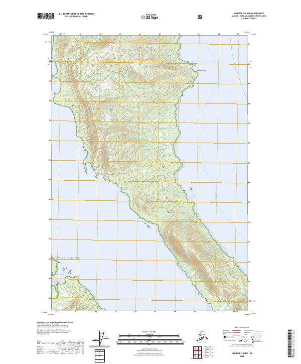
2024 Map of Sumdum C-6 NW
USGS Topo · Published 2024About this map
Tongass National Forest and the Admiralty Island National Monument Kootznoowoo Wilderness encompass the entirety of this coastal landscape. The landform is dominated by the narrow, elongated Glass Peninsula, which stretches toward the southeast. The interior terrain is defined by dramatic elevation changes, notably at The Stone Wall, a prominent ridge overlooking the western coastline. The shoreline is punctuated by secluded water features like Sore Finger Cove in the northwest and Peasant Bay to the southwest. This 2024 survey reflects a protected wilderness area where modern infrastructure is absent, emphasizing the preserved natural state of the Alaska Panhandle. Coastal markers such as Midway Point serve as the primary landmarks for navigating the complex waterways of the Hoonah-Angoon Census Area.
Find a feature on this map
14 named features on this map. Tap any name to fly to it.
Don’t see what you’re looking for? This feature index may not catch every label — zoom into the map to look around manually.
Map Details
Editions of this 2024 Sumdum C-6 NW Map
This is the sole edition of this map. No revisions or reprints were ever made.
Other maps of this area

1948 · Sitka D-1
USGS Topo · 1:63,360

1948 · Sitka C-1
USGS Topo · 1:63,360

1948 · Sumdum D-6
USGS Topo · 1:63,360

1948 · Sumdum C-6
USGS Topo · 1:63,360

1951 · Sitka
USGS Topo · 1:250,000

1951 · Sitka D-1
USGS Topo · 1:63,360

1951 · Sumdum D-6
USGS Topo · 1:63,360

1951 · Sitka C-1
USGS Topo · 1:63,360

1951 · Sumdum C-6
USGS Topo · 1:63,360

1952 · Sumdum
USGS Topo · 1:250,000