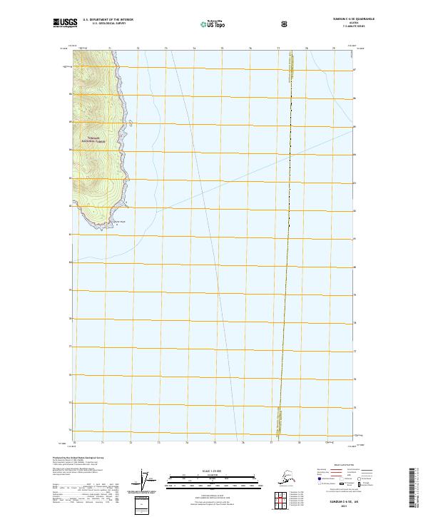
2021 Map of Sumdum C-6 SE
USGS Topo · Published 2021About this map
Tongass National Forest dominates the terrestrial landscape of this coastal survey, where the dense wilderness of Southeast Alaska meets the waters of the Inside Passage. The map documents a rugged peninsula culminating at Point Hugh, a significant maritime landmark at the southern tip of the landmass. This 2021 edition provides a contemporary look at the administrative landscape of the region, specifically the boundary line between the Hoonah-Angoon Census Area and the Petersburg Borough. The topography is defined by steep coastal rises from the shoreline, characteristic of the Alexander Archipelago's remote islands and mainland reaches, with little to no human infrastructure visible beyond the official township and range demarcations.
Find a feature on this map
6 named features on this map. Tap any name to fly to it.
Don’t see what you’re looking for? This feature index may not catch every label — zoom into the map to look around manually.
Map Details
Editions of this 2021 Sumdum C-6 SE Map
This is the sole edition of this map. No revisions or reprints were ever made.
Other maps of this area

1948 · Sumdum C-5
USGS Topo · 1:63,360

1948 · Sumdum B-6
USGS Topo · 1:63,360

1948 · Sumdum C-6
USGS Topo · 1:63,360

1948 · Sumdum B-5
USGS Topo · 1:63,360

1951 · Sumdum C-5
USGS Topo · 1:63,360

1951 · Sumdum B-5
USGS Topo · 1:63,360

1951 · Sumdum C-6
USGS Topo · 1:63,360

1952 · Sumdum
USGS Topo · 1:250,000

1961 · Sumdum
USGS Topo · 1:250,000
1996 · Sumdum B-5
USGS Topo · 1:63,360