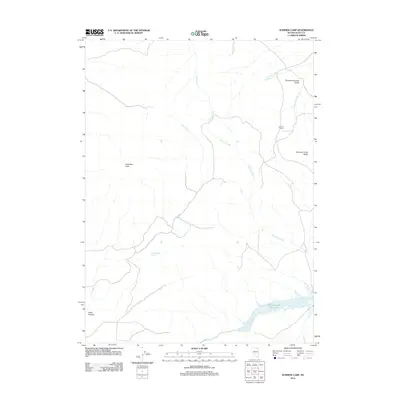
2012 Map of Summer Camp
USGS Topo · Published 2012About this map
Summer Camp sits at the transition between the high desert peaks and the hydrologic network of northeastern Nevada. The landscape is dominated by the prominence of Antelope Peak and the namesake Summer Camp Ridge, which overlook a complex system of seasonal and perennial watercourses. The northern reaches are defined by the Thousand Springs Valley, where Thousand Springs Creek flows through the arid basin. To the south, the water management of the region is evident at the Bishop Creek Reservoir, fed by Bishop Creek. This 2012 survey by the U.S. Geological Survey captures the specialized geography of the area, illustrating how isolated springs like Trough Canyon Spring and drainages such as Finks Canyon support life and livestock in the remote Elko County interior.
Find a feature on this map
13 named features on this map. Tap any name to fly to it.
Don’t see what you’re looking for? This feature index may not catch every label — zoom into the map to look around manually.
Map Details
Editions of this 2012 Summer Camp Map
This is the sole edition of this map. No revisions or reprints were ever made.
Other maps of this area

1955 · Wells
USGS Topo · 1:250,000

1958 · Wells
USGS Topo · 1:250,000

1961 · Wells
USGS Topo · 1:250,000

1967 · Black Butte
USGS Topo · 1:24,000

1967 · Black Butte NE
USGS Topo · 1:24,000

1967 · Metropolis
USGS Topo · 1:24,000

1968 · Wilkins
USGS Topo · 1:24,000

1968 · Melandco
USGS Topo · 1:24,000

1968 · Wells Peak
USGS Topo · 1:24,000

1968 · Summer Camp
USGS Topo · 1:24,000