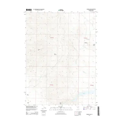
2014 Map of Summer Camp
USGS Topo · Published 2014About this map
The Snake Mountains dominate this high-desert landscape in Elko County, defined by steep relief and a complex network of seasonal drainage. Elevated features like Antelope Peak and Summer Camp Ridge provide significant vantage points over the surrounding basins, including the broad Thousand Springs Valley. The map reveals a land managed for its scarce water resources, centered on the Bishop Cr Reservoir in the southern portion of the quadrangle. Local hydrology is further marked by Trough Canyon Spring and the winding paths of Thousand Springs Cr and Johnson Cr. The namesake settlement of Summer Camp sits at the eastern edge of the mountains, representing the sparse but resilient human footprint in this corner of the Great Basin. From the depths of Finks Canyon to the expanse of Bishop Flats, the topography indicates a region utilized for ranching and resource management.
Find a feature on this map
19 named features on this map. Tap any name to fly to it.
Don’t see what you’re looking for? This feature index may not catch every label — zoom into the map to look around manually.
Map Details
Editions of this 2014 Summer Camp Map
This is the sole edition of this map. No revisions or reprints were ever made.
Other maps of this area

1955 · Wells
USGS Topo · 1:250,000

1958 · Wells
USGS Topo · 1:250,000

1961 · Wells
USGS Topo · 1:250,000

1967 · Black Butte
USGS Topo · 1:24,000

1967 · Black Butte NE
USGS Topo · 1:24,000

1967 · Metropolis
USGS Topo · 1:24,000

1968 · Wilkins
USGS Topo · 1:24,000

1968 · Melandco
USGS Topo · 1:24,000

1968 · Wells Peak
USGS Topo · 1:24,000

1968 · Summer Camp
USGS Topo · 1:24,000