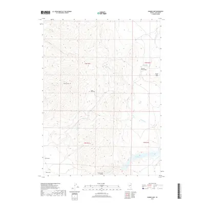
2018 Map of Summer Camp
USGS Topo · Published 2018About this map
Snake Mountains terrain dominates this portion of Elko County, where high peaks and deep canyons dictate the flow of water and human movement. In the northern reaches, the Summer Camp settlement sits at the edge of the Thousand Springs Valley, sheltered by the prominent Summer Camp Ridge. This high-altitude landscape is defined by its drainage systems, including Thousand Springs Cr and the waters of Pole Cr, which carve through the high desert. To the south, the terrain descends into Bishop Creek Canyon and the broad Bishop Flats, where the Bishop Creek Reservoir serves as a critical water source. The presence of Trough Canyon Spring and other intermittent flows like Trout Cr illustrate the vital importance of water management in this arid Nevada environment, providing a detailed look at the hydrology supporting the region's ranching and seasonal grazing history.
Find a feature on this map
19 named features on this map. Tap any name to fly to it.
Don’t see what you’re looking for? This feature index may not catch every label — zoom into the map to look around manually.
Map Details
Editions of this 2018 Summer Camp Map
This is the sole edition of this map. No revisions or reprints were ever made.
Other maps of this area

1955 · Wells
USGS Topo · 1:250,000

1958 · Wells
USGS Topo · 1:250,000

1961 · Wells
USGS Topo · 1:250,000

1967 · Black Butte
USGS Topo · 1:24,000

1967 · Black Butte NE
USGS Topo · 1:24,000

1967 · Metropolis
USGS Topo · 1:24,000

1968 · Wilkins
USGS Topo · 1:24,000

1968 · Melandco
USGS Topo · 1:24,000

1968 · Wells Peak
USGS Topo · 1:24,000

1968 · Summer Camp
USGS Topo · 1:24,000