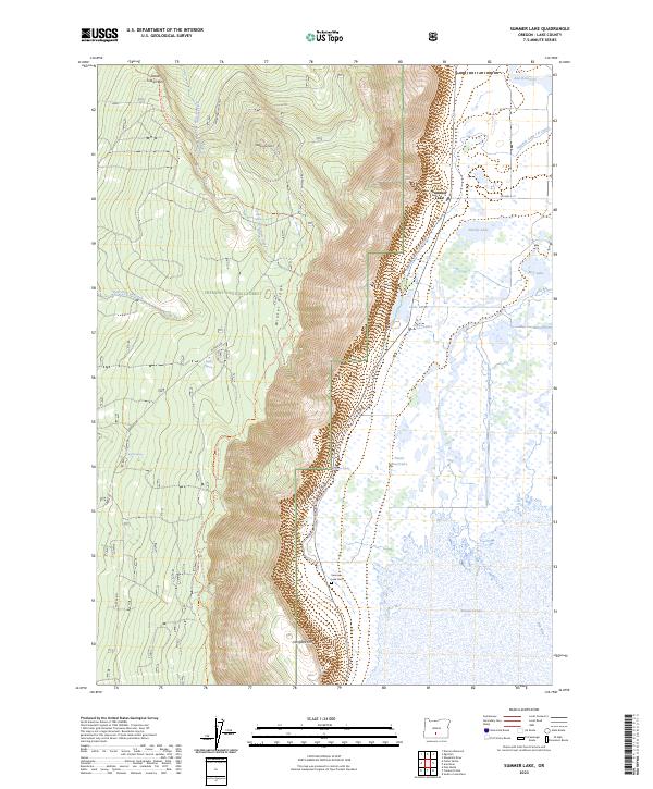
2023 Map of Summer Lake
USGS Topo · Published 2023About this map
Winter Rim and Winter Ridge form a dramatic geographic spine overlooking the basin of Summer Lake in Lake County. This modern survey illustrates the complex water management system of the high desert, featuring the Summer Lake I D Canal, the Ana River, and the Foster Reservoirs. The landscape is defined by the sharp transition from the elevated terrain of the Fremont National Forest down to the sprawling Summer Lake Migratory Waterfowl and Game Management Area. Settled life is concentrated along the eastern foothills of the rim near the Summer Lake community and the Summer Lake Cem. A network of springs, such as Dead Indian Spring and Bagley Spring, dot the base of the ridges, feeding into local water bodies like Dutchy Lake and Rest Lake. This map captures the continued coexistence of recreational trails, like the Southern Oregon Intertie Trl, and the critical wetland habitats essential to the region.
Find a feature on this map
32 named features on this map. Tap any name to fly to it.
Don’t see what you’re looking for? This feature index may not catch every label — zoom into the map to look around manually.
Map Details
Editions of this 2023 Summer Lake Map
This is the sole edition of this map. No revisions or reprints were ever made.
Other maps of this area

1955 · Crescent
USGS Topo · 1:250,000

1955 · Klamath Falls
USGS Topo · 1:250,000

1957 · Crescent
USGS Topo · 1:250,000

1958 · Crescent
USGS Topo · 1:250,000

1958 · Klamath Falls
USGS Topo · 1:250,000

1966 · Summer Lake
USGS Topo · 1:24,000

1966 · Fremont Point
USGS Topo · 1:24,000

1966 · Pole Butte
USGS Topo · 1:24,000

1966 · Foster Butte
USGS Topo · 1:24,000

1970 · Crescent
USGS Topo · 1:250,000