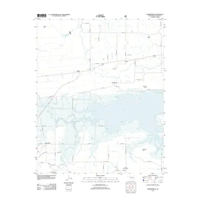
2013 Map of Summerfield
USGS Topo · Published 2013About this map
Summerfield and the lowlands of the Fourche Maline dominate this portion of LeFlore County, where the landscape is defined by the expansive waters of Wister Lake. The map reveals a complex system of local roads, such as Co RD-e1450, that navigate the irregular shoreline and marshy fingers of the reservoir. To the north, the terrain transitions into a series of distinctive elevations including Buzzards Roost and Goat Ridge, while the small community of Victor sits along a primary east-west corridor.
Find a feature on this map
54 named features on this map. Tap any name to fly to it.
Don’t see what you’re looking for? This feature index may not catch every label — zoom into the map to look around manually.
Map Details
Editions of this 2013 Summerfield Map
This is the sole edition of this map. No revisions or reprints were ever made.
Other maps of this area

1900 · Sallisaw
USGS Topo · 1:125,000

1900 · Winding Stair
USGS Topo · 1:125,000

1909 · Winding Stair
USGS Topo · 1:125,000

1911 · Sallisaw
USGS Topo · 1:125,000

1946 · Fort Smith
USGS Topo · 1:250,000

1950 · Mcalester
USGS Topo · 1:250,000

1959 · Heavener
USGS Topo · 1:62,500

1962 · McAlester
USGS Topo · 1:250,000

1965 · Fort Smith
USGS Topo · 1:250,000

1965 · McAlester
USGS Topo · 1:250,000