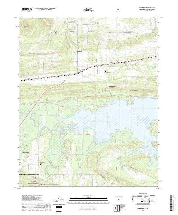
2022 Map of Summerfield
USGS Topo · Published 2022About this map
The Ouachita National Forest anchors the southern portion of this region, where the rugged terrain of Yellow Spring Ridge and Horseshoe Ridge gives way to the wetlands surrounding Wister Lake. The northern landscape is defined by a series of parallel ridges, including Goat Ridge and the prominent Sulphur Spring Mtn, which frame the valley corridors of Caston Creek and Cedar Cr. Small communities like Summerfield and Fanshawe are connected by a network of rural routes, while the eastern edge is marked by the meandering Poteau River. Significant local landmarks such as Goats Bluff and the family history sites of Summerfield Cem and Maxey Cem provide specific points of interest for those exploring the social and physical geography of this corner of Oklahoma. The transition from timbered ridges to the alluvial systems of Fourche Maline highlights a landscape balancing forest conservation with local habitation.
Find a feature on this map
77 named features on this map. Tap any name to fly to it.
Don’t see what you’re looking for? This feature index may not catch every label — zoom into the map to look around manually.
Map Details
Editions of this 2022 Summerfield Map
This is the sole edition of this map. No revisions or reprints were ever made.
Other maps of this area

1900 · Sallisaw
USGS Topo · 1:125,000

1900 · Winding Stair
USGS Topo · 1:125,000

1909 · Winding Stair
USGS Topo · 1:125,000

1911 · Sallisaw
USGS Topo · 1:125,000

1946 · Fort Smith
USGS Topo · 1:250,000

1950 · Mcalester
USGS Topo · 1:250,000

1959 · Heavener
USGS Topo · 1:62,500

1962 · McAlester
USGS Topo · 1:250,000

1965 · Fort Smith
USGS Topo · 1:250,000

1965 · McAlester
USGS Topo · 1:250,000