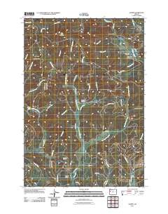
2011 Map of Summit
USGS Topo · Published 2011About this map
Summit and the nearby settlement of Nashville serve as the primary hubs in this corner of the Oregon Coast Range, where the headwaters of several major drainage systems diverge. The landscape is defined by its complex hydrology, featuring the winding Yaquina River, the Luckiamute River, and the Marys River. For those researching local history or genealogy, the presence of Summit Cemetery, May Stouts Cemetery, and Claremont Cemetery provides concrete anchors to the early families of the region. The map highlights the high-elevation terrain between Little Grass Mountain and Bonner Mountain, illustrating a network of logging and access roads like Marys River Rd and Gage Rd that connect isolated clearings and camps. Distinctive landmarks such as Happy Hollow and Granite Canyon reveal the varied geography of this timber-rich environment at the start of the 2010s.
Find a feature on this map
50 named features on this map. Tap any name to fly to it.
Don’t see what you’re looking for? This feature index may not catch every label — zoom into the map to look around manually.
Map Details
Editions of this 2011 Summit Map
This is the sole edition of this map. No revisions or reprints were ever made.
Other maps of this area

1921 · Corvallis
USGS Topo · 1:62,500

1939 · Marys Peak
USGS Topo · 1:62,500

1942 · Marys Peak
USGS Topo · 1:62,500

1942 · Corvallis
USGS Topo · 1:62,500

1942 · Valsetz
USGS Topo · 1:62,500

1942 · Dallas
USGS Topo · 1:62,500

1953 · Salem
USGS Topo · 1:250,000

1954 · Salem
USGS Topo · 1:250,000
1956 · Corvallis
USGS Topo · 1:62,500

1956 · Valsetz
USGS Topo · 1:62,500