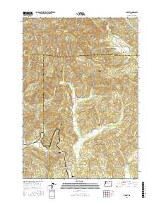
2017 Map of Summit
USGS Topo · Published 2017About this map
Summit and Nashville anchor this pocket of the Oregon Coast Range, where the headwaters of several major river systems converge. The terrain is defined by the high ridges of Green Mtn and Little Grass Mtn, which separate the drainages of the Yaquina River flowing west and the Marys River and Luckiamute River flowing toward the Willamette Valley. This 2017 survey reveals a landscape deeply connected to its drainage patterns, with roads like Marys River Rd and Norton Creek Rd following the narrow valley floors between steep timbered slopes. For local history researchers, the map identifies several significant rural landmarks including Claremont Cem, Strout Cem, and Summit Cem, alongside geographical features like Strout Spring and the secluded Granite Canyon. These sites, along with the small settlement at Happy Hollow, offer a detailed look at the persistent footprints of community and family in this high-elevation pass.
Find a feature on this map
73 named features on this map. Tap any name to fly to it.
Don’t see what you’re looking for? This feature index may not catch every label — zoom into the map to look around manually.
Map Details
Editions of this 2017 Summit Map
This is the sole edition of this map. No revisions or reprints were ever made.
Other maps of this area

1921 · Corvallis
USGS Topo · 1:62,500

1939 · Marys Peak
USGS Topo · 1:62,500

1942 · Marys Peak
USGS Topo · 1:62,500

1942 · Corvallis
USGS Topo · 1:62,500

1942 · Valsetz
USGS Topo · 1:62,500

1942 · Dallas
USGS Topo · 1:62,500

1953 · Salem
USGS Topo · 1:250,000

1954 · Salem
USGS Topo · 1:250,000
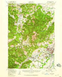
1956 · Corvallis
USGS Topo · 1:62,500

1956 · Valsetz
USGS Topo · 1:62,500