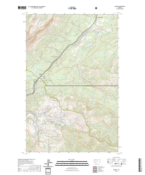
2024 Map of Summit
USGS Topo · Published 2024About this map
Marias Pass serves as the central high-altitude gateway through the Continental Divide, anchoring this survey of the boundary between Glacier National Park, Lewis & Clark National Forest, and Flathead National Forest. The small settlement of Summit sits at this critical crossing point, where the landscape transitions into the steep John F Stevens Canyon to the west. This area is a significant corridor for both modern transit and historical exploration, featuring the Theodore Roosevelt Pass and the Lewis and Clark Range. The map reveals a dense network of wilderness trails, including the Continental Divide National Scenic Trl and the Firebrand Pass Trl, which navigate a complex terrain of named peaks such as Skeleton Mtn and False Summit. Water features like Three Bears Lake and the South Fork Two Medicine River illustrate the hydrological importance of this divide.
Find a feature on this map
50 named features on this map. Tap any name to fly to it.
Don’t see what you’re looking for? This feature index may not catch every label — zoom into the map to look around manually.
Map Details
Editions of this 2024 Summit Map
This is the sole edition of this map. No revisions or reprints were ever made.
Other maps of this area

1913 · Marias Pass
USGS Topo · 1:125,000

1958 · Red Plume Mountain
USGS Topo · 1:24,000

1958 · Crescent Cliff
USGS Topo · 1:24,000

1958 · Mount Bradley
USGS Topo · 1:24,000

1960 · Cut Bank
USGS Topo · 1:250,000

1963 · Cut Bank
USGS Topo · 1:250,000

1964 · Cut Bank
USGS Topo · 1:250,000
1968 · Blacktail
USGS Topo · 1:24,000
1968 · Mount Rockwell
USGS Topo · 1:24,000
1968 · East Glacier Park
USGS Topo · 1:24,000