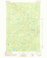
1985 Map of Summit Lake
USGS Topo · Published 1985About this map
Glacial lakes and headwater streams dominate this remote Upper Peninsula landscape, straddling the boundary of Baraga and Marquette Counties. Much of the eastern terrain is occupied by the Cyrus H. Mc Cormick Experimental Forest, a tract known for its undisturbed wilderness character. The area serves as a significant hydrological divide, where the West Branch Huron River flows north toward Lake Superior while the Peshekee River drains the southern portion of the quadrangle. Sparse human imprints like Boniface Camp and the fringes of Craig Lake State Park highlight the region's character as a managed timber and recreational forest. The map reveals a complex network of water bodies, from the central Summit Lake to the interconnected Upper Baraga Lake and Lower Baraga Lake, illustrating the post-glacial topography of the Michigamme Highlands.
Find a feature on this map
42 named features on this map. Tap any name to fly to it.
Don’t see what you’re looking for? This feature index may not catch every label — zoom into the map to look around manually.
Map Details
Editions of this 1985 Summit Lake Map
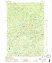
2 editions found
Other maps of this area

1954 · Huron Mountain
USGS Topo · 1:62,500

1954 · Skanee
USGS Topo · 1:62,500

1955 · Champion
USGS Topo · 1:24,000

1955 · Champion
USGS Topo · 1:62,500

1956 · Three Lakes
USGS Topo · 1:24,000

1956 · Michigamme
USGS Topo · 1:62,500

1956 · Michigamme
USGS Topo · 1:24,000

1958 · Marquette
USGS Topo · 1:250,000

1958 · Iron River
USGS Topo · 1:250,000

1960 · Iron River
USGS Topo · 1:250,000