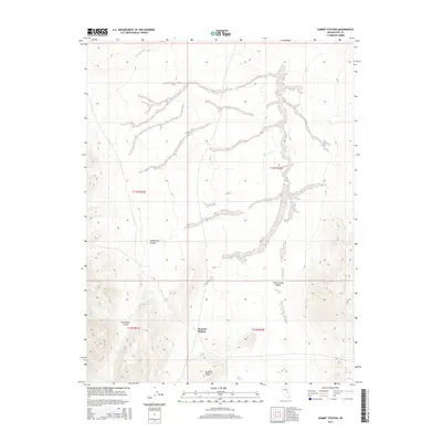
2014 Map of Summit Station
USGS Topo · Published 2014About this map
Summit Station serves as the namesake reference point for this portion of the high Nevada desert, situated along a prominent north-south transit corridor. The terrain is defined by the broad floor of Little Smoky Valley, which is flanked by the rising slopes of Andesite Ridge and the complex drainage systems of Big Fault Wash. To the west, the landscape is punctuated by the deep cuts of Hildebrand Canyon and Twin Piñon Gulch, revealing a network of seasonal watercourses and essential desert water sources like Rock Spring. This USGS topographic study illustrates the sparse but critical geographic landmarks used by travelers and researchers navigating this portion of Nye County in the early twenty-first century.
Find a feature on this map
11 named features on this map. Tap any name to fly to it.
Don’t see what you’re looking for? This feature index may not catch every label — zoom into the map to look around manually.
Map Details
Editions of this 2014 Summit Station Map
This is the sole edition of this map. No revisions or reprints were ever made.
Other maps of this area

1926 · Roberts Mountains
USGS Topo · 1:250,000

1929 · Roberts Mountains
USGS Topo · 1:250,000

1955 · Millett
USGS Topo · 1:250,000

1956 · Cockalorum Wash
USGS Topo · 1:62,500

1956 · Lund
USGS Topo · 1:250,000

1956 · Ely
USGS Topo · 1:250,000

1956 · Tonopah
USGS Topo · 1:250,000

1959 · Ely
USGS Topo · 1:250,000

1959 · Tonopah
USGS Topo · 1:250,000

1959 · Millett
USGS Topo · 1:250,000