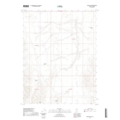
2018 Map of Summit Station
USGS Topo · Published 2018About this map
Monitor Valley and Little Smoky Valley dominate this Great Basin landscape, separated by the high ground of Andesite Ridge. This remote portion of Nye County is characterized by dramatic elevation changes and dry drainage systems, such as Big Fault Wash and Hildebrand Canyon. A rare water source, Rock Spring, is located at the southern base of the ridge, suggesting its importance to local travel and livestock in an otherwise arid environment. The map details the rugged transitions between these two major valley systems and Twin Pihon Gulch, capturing the topography of the central Nevada desert as it remains largely untouched by modern development.
Find a feature on this map
12 named features on this map. Tap any name to fly to it.
Don’t see what you’re looking for? This feature index may not catch every label — zoom into the map to look around manually.
Map Details
Editions of this 2018 Summit Station Map
This is the sole edition of this map. No revisions or reprints were ever made.
Other maps of this area

1926 · Roberts Mountains
USGS Topo · 1:250,000

1929 · Roberts Mountains
USGS Topo · 1:250,000

1955 · Millett
USGS Topo · 1:250,000

1956 · Cockalorum Wash
USGS Topo · 1:62,500

1956 · Lund
USGS Topo · 1:250,000

1956 · Ely
USGS Topo · 1:250,000

1956 · Tonopah
USGS Topo · 1:250,000

1959 · Ely
USGS Topo · 1:250,000

1959 · Tonopah
USGS Topo · 1:250,000

1959 · Millett
USGS Topo · 1:250,000