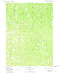
1981 Map of Summit Valley
USGS Topo · Published 1982About this map
Six Rivers National Forest dominates this landscape, characterized by the complex drainage systems of Blue Creek and its various forks. High-altitude landmarks like Doctor Rock and South Red Mtn anchor the terrain, while the Summit Valley Trail provides a route through the backcountry toward the Summit Valley Shelter. This 1981 survey documents a territory defined by timber management and remote access, evidenced by the presence of several Borrow Pit sites and a Quarry near the Crescent City Fork. The network of seasonal water sources, such as Woolly Bear Spring and Cedar Camp Spring, along with the prominent G-O Road, illustrates the infrastructure required to navigate this isolated portion of Del Norte County. The map captures a specific moment in the land-use history of the Siskiyou Mountains before significant shifts in regional forest policy.
Find a feature on this map
22 named features on this map. Tap any name to fly to it.
Don’t see what you’re looking for? This feature index may not catch every label — zoom into the map to look around manually.
Map Details
Editions of this 1981 Summit Valley Map
This is the sole edition of this map. No revisions or reprints were ever made.
Other maps of this area

1922 · Preston Peak
USGS Topo · 1:125,000

1925 · Hoopa
USGS Topo · 1:125,000

1945 · Ship Mountain
USGS Topo · 1:62,500

1945 · Tectah Creek
USGS Topo · 1:62,500

1948 · Weed
USGS Topo · 1:250,000

1950 · Weed
USGS Topo · 1:250,000

1952 · Ship Mountain
USGS Topo · 1:62,500

1952 · Orleans
USGS Topo · 1:62,500

1952 · Tectah Creek
USGS Topo · 1:62,500

1955 · Dillon Mtn
USGS Topo · 1:62,500