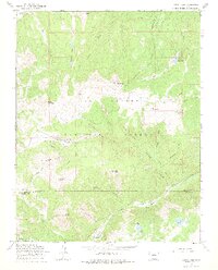
1967 Map of Summitville
USGS Topo · Published 1974About this map
Summitville serves as the focal point of this high-altitude landscape, situated at the headwaters of the Wightman Fork. The terrain is defined by a dense concentration of mining infrastructure, specifically clustered around South Mountain and Cropsy Mountain. Notable underground workings such as the Chandler Tunnel, French Tunnel, and Lower Tunnel indicate the heavy subsurface industrial activity of the period.
Find a feature on this map
54 named features on this map. Tap any name to fly to it.
Don’t see what you’re looking for? This feature index may not catch every label — zoom into the map to look around manually.
Map Details
Editions of this 1967 Summitville Map
4 editions found
Other maps of this area

1913 · Summitville
USGS Topo · 1:125,000

1914 · Creede
USGS Topo · 1:125,000

1915 · Summitville
USGS Topo · 1:125,000

1915 · Del Norte
USGS Topo · 1:125,000

1916 · Creede
USGS Topo · 1:125,000

1917 · Del Norte
USGS Topo · 1:125,000

1922 · Conejos
USGS Topo · 1:125,000

1945 · Durango
USGS Topo · 1:250,000

1953 · Durango
USGS Topo · 1:250,000

1954 · Durango
USGS Topo · 1:250,000