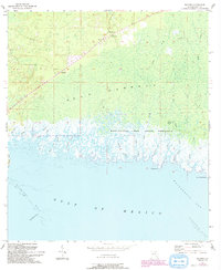
1955 Map of Sumner
USGS Topo · Published 1993About this map
Rosewood and Sumner anchor the northern landscape of this Florida Gulf Coast survey, where the dense timber of Gulf Hammock meets the intricate tidal network of the Waccasassa Bay State Preserve. The map documents a rugged coastal transition zone defined by numerous small waterways such as Wilder Creek and Porpoise Creek that drain into the Waccasassa Bay. Local landmarks like the Suwannee Lookout Tower and Shiloh Cem provide key points of reference for genealogists and local historians studying the inland settlements. Offshore, the topography shifts to the maritime hazards and natural features of the Gulf, including Corrigan Reef and Waccasassa Reefs. The presence of Big Stake Gap and various points like Kelly Creek Point illustrates the complex, fragmented shoreline that has long shaped the navigation and economy of this portion of Levy County.
Find a feature on this map
34 named features on this map. Tap any name to fly to it.
Don’t see what you’re looking for? This feature index may not catch every label — zoom into the map to look around manually.
Map Details
Editions of this 1955 Sumner Map
4 editions found
Other maps of this area

1954 · Otter Creek
USGS Topo · 1:24,000

1954 · Chiefland SW
USGS Topo · 1:24,000

1954 · East Pass
USGS Topo · 1:24,000

1954 · Gainesville
USGS Topo · 1:250,000

1955 · Seahorse Key
USGS Topo · 1:24,000

1955 · Cedar Key
USGS Topo · 1:24,000

1955 · Withlacoochee Bay
USGS Topo · 1:24,000

1955 · Waccasassa Bay
USGS Topo · 1:24,000

1955 · Sumner
USGS Topo · 1:24,000

1958 · Gainesville
USGS Topo · 1:250,000