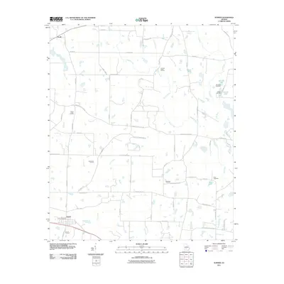
2011 Map of Sumner
USGS Topo · Published 2011About this map
The town of Sumner anchors this landscape in southwest Georgia, featuring the local Sumner Post Office and several family and community landmarks. The area is defined by a dense network of waterways including the Little River, Ty Ty Creek, and Daniels Creek, which feed into local impoundments like Winfreds Lake and Wiltons Lake. The rural character of Worth County is evident in the numerous burial grounds scattered across the terrain, from the Old Sumner Cemetery to the Clements Chapel Cemetery and Millers Chapel Cemetery. These sites, along with the settlement of Terrell in the northwest, reflect the generational stability of this agricultural and creek-bottom region. The road network, including Shingler Little River Rd and Whiddon Mill Rd, connects isolated farmsteads and points of local industry such as the Ross Lake Dam.
Find a feature on this map
69 named features on this map. Tap any name to fly to it.
Don’t see what you’re looking for? This feature index may not catch every label — zoom into the map to look around manually.
Map Details
Editions of this 2011 Sumner Map
This is the sole edition of this map. No revisions or reprints were ever made.
Other maps of this area

1953 · Waycross
USGS Topo · 1:250,000

1956 · Sylvester
USGS Topo · 1:62,500

1956 · Doerun
USGS Topo · 1:62,500

1958 · Waycross
USGS Topo · 1:250,000

1972 · Cuffietown
USGS Topo · 1:24,000

1973 · Sumner
USGS Topo · 1:24,000

1973 · Ty Ty
USGS Topo · 1:24,000

1973 · Sylvester
USGS Topo · 1:24,000

1973 · Ashburn
USGS Topo · 1:24,000

1973 · Chula
USGS Topo · 1:24,000