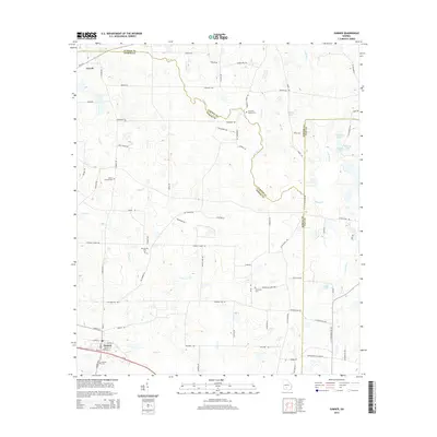
2014 Map of Sumner
USGS Topo · Published 2014About this map
Sumner serves as the primary hub in this South Georgia landscape, where the town grid is established at the intersection of local roads and the railroad corridor. The area is defined by a dense network of family-named roads and drainage systems, including the headwaters and branches of Little River and Ty Ty Cr. For genealogists and local historians, the sheet is particularly valuable for its documentation of several rural burial grounds, ranging from the Old Sumner Cem to the Clements Chapel Cem and Damascus Cem. To the northwest, the small settlement of Terrell marks another point of historical interest amidst the agricultural fields. The geography is notably intricate along the county lines of Worth, Turner, and Tift, where the meandering path of Daniels Cr and Big Br dictate the political boundaries, illustrating how the natural hydrology of the coastal plain shaped the region's jurisdictional layout.
Find a feature on this map
81 named features on this map. Tap any name to fly to it.
Don’t see what you’re looking for? This feature index may not catch every label — zoom into the map to look around manually.
Map Details
Editions of this 2014 Sumner Map
This is the sole edition of this map. No revisions or reprints were ever made.
Other maps of this area

1953 · Waycross
USGS Topo · 1:250,000

1956 · Sylvester
USGS Topo · 1:62,500

1956 · Doerun
USGS Topo · 1:62,500

1958 · Waycross
USGS Topo · 1:250,000

1972 · Cuffietown
USGS Topo · 1:24,000

1973 · Sumner
USGS Topo · 1:24,000

1973 · Ty Ty
USGS Topo · 1:24,000

1973 · Sylvester
USGS Topo · 1:24,000

1973 · Ashburn
USGS Topo · 1:24,000

1973 · Chula
USGS Topo · 1:24,000