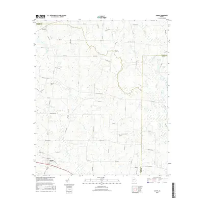
2017 Map of Sumner
USGS Topo · Published 2017About this map
Sumner and Terrell anchor this agricultural landscape in Southwest Georgia, situated where the borders of Worth, Turner, and Tift Counties converge. The topography is defined by the winding course of the Little River and numerous tributaries like Big Br, Little Cr, and Daniels Cr. This 2017 survey reveals a deeply rooted rural community, evidenced by a high density of generational burial sites such as Sumner Cem, the Old Sumner Cem, and Millers Chapel Cem. The area’s hydrology is notable for several established water bodies, including Winfreds Lake, Wiltons Lake, and Cravey Pond. Local roads often follow family names or geographic landmarks, such as Shepherd Rd and Tifton Worth Co Line Rd, illustrating the intersection of private landholdings and civil boundaries in this established farming region.
Find a feature on this map
80 named features on this map. Tap any name to fly to it.
Don’t see what you’re looking for? This feature index may not catch every label — zoom into the map to look around manually.
Map Details
Editions of this 2017 Sumner Map
This is the sole edition of this map. No revisions or reprints were ever made.
Other maps of this area

1953 · Waycross
USGS Topo · 1:250,000

1956 · Sylvester
USGS Topo · 1:62,500

1956 · Doerun
USGS Topo · 1:62,500

1958 · Waycross
USGS Topo · 1:250,000

1972 · Cuffietown
USGS Topo · 1:24,000

1973 · Sumner
USGS Topo · 1:24,000

1973 · Ty Ty
USGS Topo · 1:24,000

1973 · Sylvester
USGS Topo · 1:24,000

1973 · Ashburn
USGS Topo · 1:24,000

1973 · Chula
USGS Topo · 1:24,000