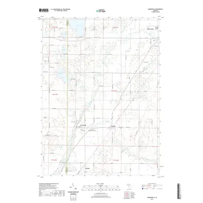
2019 Map of Sumnerville
USGS Topo · Published 2019About this map
The Dowagiac River flows through a landscape defined by its glacial kettle lakes and wetland basins along the border of Berrien and Cass counties. The small settlements of Summerville and Pokagon anchor the central portion of the sheet, surrounded by significant genealogical sites including Summerville Cemetery, Evergreen Cemetery, and Rodgers Cemetery. To the north, Indian Lake and Brush Lake dominate the terrain, while the northeastern corner shows the expansion of Dowagiac near the Dowagiac Municipal Airport. The southern edge reaches the outskirts of Niles along McKinzie Creek. This modern survey reveals how the local road network, such as Old M 62 and Pucker Street Drive, traces the historical edges of the marshlands and many smaller water bodies like Bernhart Lake and Boot Lake.
Find a feature on this map
90 named features on this map. Tap any name to fly to it.
Don’t see what you’re looking for? This feature index may not catch every label — zoom into the map to look around manually.
Map Details
Editions of this 2019 Sumnerville Map
This is the sole edition of this map. No revisions or reprints were ever made.
Other maps of this area

1927 · Niles
USGS Topo · 1:62,500

1927 · Hartford
USGS Topo · 1:62,500

1927 · Benton Harbor
USGS Topo · 1:62,500

1930 · Benton Harbor
USGS Topo · 1:62,500

1930 · Niles
USGS Topo · 1:62,500

1931 · Hartford
USGS Topo · 1:62,500

1943 · Niles
USGS Topo · 1:62,500

1945 · Cassopolis
USGS Topo · 1:62,500

1947 · Cassopolis
USGS Topo · 1:62,500

1953 · Chicago
USGS Topo · 1:250,000