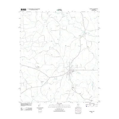
2012 Map of Sumrall
USGS Topo · Published 2012About this map
Sumrall serves as the central hub of this Lamar County landscape, where the local road network converges near the banks of Sumrall Mill Cr. The terrain is defined by a dense web of watercourses and family-named routes, with the Bouie River and Gabby Reed Brake marking the northern reaches. To the south, smaller communities like Bynum, Coral, and Epley are linked by rural corridors such as Mill Creek Loop and Sportsman Lake Rd. The map illustrates a transition from the structured street grid of the main town to the sprawling drainage systems of Tick Cr and Bear Bay. This 2012 survey provides a detailed look at the rural infrastructure and residential pockets that characterize the area, including the western settlement of Higgins, as it appeared in the early 21st century.
Find a feature on this map
105 named features on this map. Tap any name to fly to it.
Don’t see what you’re looking for? This feature index may not catch every label — zoom into the map to look around manually.
Map Details
Editions of this 2012 Sumrall Map
This is the sole edition of this map. No revisions or reprints were ever made.
Other maps of this area

1953 · Hattiesburg
USGS Topo · 1:250,000

1958 · Hattiesburg
USGS Topo · 1:250,000

1964 · Seminary
USGS Topo · 1:24,000

1965 · Hattiesburg SW
USGS Topo · 1:24,000

1965 · Sanford
USGS Topo · 1:24,000

1974 · Sumrall
USGS Topo · 1:24,000

1974 · Oloh
USGS Topo · 1:24,000

1974 · Williamsburg
USGS Topo · 1:24,000

1974 · Bassfield
USGS Topo · 1:24,000

1974 · Lake Mike Connor
USGS Topo · 1:24,000