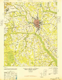
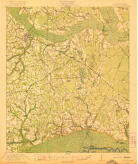
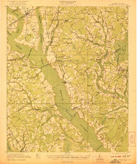
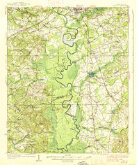
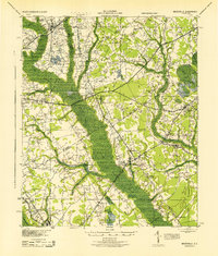
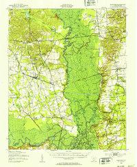
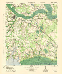
1946 Map of Sumter
USGS Topo · Published 1946About this map
Sumter anchors this mid-century landscape, characterized by a transition from a centralized urban core to an expansive network of rural schools, churches, and millponds. The presence of the U S Military Reservation (Shaw Field) and the Sumter Municipal Airport highlights the area's strategic aviation importance during the post-war era. To the west, the Poinsett State Forest covers a significant portion of the terrain, interspersed with local landmarks like McCray Lake and the Rosemary Fire Tower Road.
Find a feature on this map
99 named features on this map. Tap any name to fly to it.
Don’t see what you’re looking for? This feature index may not catch every label — zoom into the map to look around manually.
Map Details
Editions of this 1946 Sumter Map
This is the sole edition of this map. No revisions or reprints were ever made.
Other maps of this area

1920 · Mayesville
USGS Topo · 1:48,000

1920 · Manning
USGS Topo · 1:48,000
1921 · Manning
USGS Topo · 1:62,500
1921 · Mayesville
USGS Topo · 1:62,500
1938 · Hagood
USGS Topo · 1:62,500

1941 · Spartanburg
USGS Topo · 1:250,000

1942 · Camden
USGS Topo · 1:125,000
1943 · Mayesville
USGS Topo · 1:62,500
1943 · Eastover
USGS Topo · 1:62,500
1944 · Manning
USGS Topo · 1:62,500