
1957 Map of Sumter West
USGS Topo · Published 1958About this map
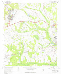
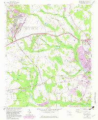
Shaw Air Force Base dominates the northwestern corner of this mid-century landscape, surrounded by the agricultural and forested lands of Sumter County. The area is characterized by an extensive network of swamps and branches, including the Green Swamp and Mush Swamp, which dictate the placement of rural settlements and transport routes. To the south, the Manchester State Forest and its associated State Forest Nursery highlight the region's managed timber resources. Local life is anchored by numerous rural houses of worship and small communities, such as St Pauls Ch, St Lukes Ch, and the settlement at Catchall-Spann. Transport and recreation are evident through the Atlantic Coast Line Railroad and local tracks like the Gamecock Raceway, while the eastern edge shows the post-war suburban growth of Sumter and Millwood Gardens.
Find a feature on this map
77 named features on this map. Tap any name to fly to it.
Don’t see what you’re looking for? This feature index may not catch every label — zoom into the map to look around manually.
Map Details
Editions of this 1957 Sumter West Map
3 editions found
Other maps of this area

1938 · Hagood
USGS Topo · 1:62,500

1941 · Spartanburg
USGS Topo · 1:250,000

1942 · Camden
USGS Topo · 1:125,000

1943 · Eastover
USGS Topo · 1:62,500

1946 · Sumter
USGS Topo · 1:62,500

1953 · Poinsett State Park
USGS Topo · 1:24,000

1953 · Wedgefield
USGS Topo · 1:24,000

1953 · Rembert
USGS Topo · 1:24,000

1953 · Spartanburg
USGS Topo · 1:250,000

1954 · Augusta
USGS Topo · 1:250,000