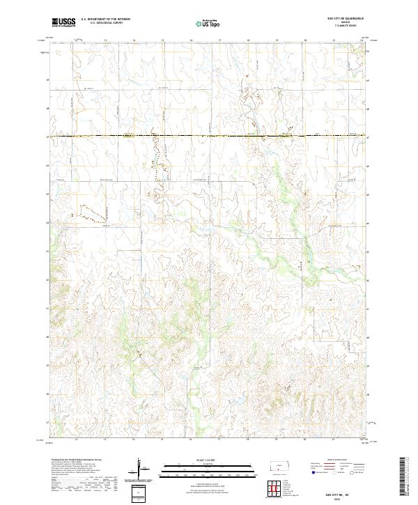
2022 Map of Sun City NE
USGS Topo · Published 2022About this map
The rolling plains of South Central Kansas define this landscape, where the Pratt Co Barber Co line bisects a network of seasonal watercourses and rural thoroughfares. Numerous branches of Elm Creek dominate the drainage pattern, including the East Branch South Elm Creek and the confluence of W Br S Elm Cr and E Br S Elm Cr. The terrain is deeply incised by these drainages, creating a complex series of ridges and draws that influenced the placement of local transport routes like Nw Elm Mills Rd and Mcadoo Rd.
Find a feature on this map
20 named features on this map. Tap any name to fly to it.
Don’t see what you’re looking for? This feature index may not catch every label — zoom into the map to look around manually.
Map Details
Editions of this 2022 Sun City NE Map
This is the sole edition of this map. No revisions or reprints were ever made.
Other maps of this area

1891 · Medicine Lodge
USGS Topo · 1:125,000

1892 · Pratt
USGS Topo · 1:125,000

1893 · Medicine Lodge
USGS Topo · 1:125,000

1894 · Pratt
USGS Topo · 1:125,000

1955 · Pratt
USGS Topo · 1:250,000

1959 · Pratt
USGS Topo · 1:250,000

1968 · Sun City SW
USGS Topo · 1:24,000

1968 · Pratt SW
USGS Topo · 1:24,000
1968 · Sun City
USGS Topo · 1:24,000

1968 · Coats
USGS Topo · 1:24,000