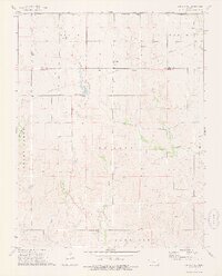
1973 Map of Sun City NE
USGS Topo · Published 1975About this map
The Old Indian Treaty Boundary slices across this portion of south-central Kansas, marking a significant historical line of demarcation between Barber County and Pratt County. This landscape is defined by the convergence of several major drainage systems, including Turkey Creek, Mulberry Creek, and the West Branch and East Branch which feed into Macadoo Dam. The drainage patterns suggest a terrain of varied elevations where water management was central to local land use. Industrial activity is evident through scattered Oil Wells, a larger Oil Field to the north, and a centralized Pipeline network. The map records the early 1970s character of these townships, showing a rural economy anchored by energy extraction and agriculture, with minor landmarks like the Gravel Pit and numerous small creek crossings providing a detailed look at the local infrastructure before modern developments.
Find a feature on this map
21 named features on this map. Tap any name to fly to it.
Don’t see what you’re looking for? This feature index may not catch every label — zoom into the map to look around manually.
Map Details
Editions of this 1973 Sun City NE Map
This is the sole edition of this map. No revisions or reprints were ever made.
Other maps of this area

1891 · Medicine Lodge
USGS Topo · 1:125,000

1892 · Pratt
USGS Topo · 1:125,000

1893 · Medicine Lodge
USGS Topo · 1:125,000

1894 · Pratt
USGS Topo · 1:125,000

1955 · Pratt
USGS Topo · 1:250,000

1959 · Pratt
USGS Topo · 1:250,000

1968 · Sun City SW
USGS Topo · 1:24,000

1968 · Pratt SW
USGS Topo · 1:24,000
1968 · Sun City
USGS Topo · 1:24,000

1968 · Coats
USGS Topo · 1:24,000