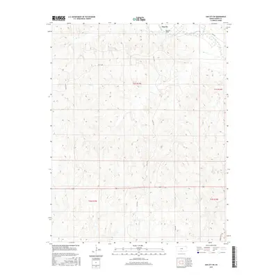
2015 Map of Sun City SW
USGS Topo · Published 2015About this map
The Medicine Lodge River winds through the northeast corner of this Barber County landscape, where the small settlement of Sun City is positioned near the confluence of Turkey Cr. The terrain is defined by a dense network of intermittent drainage channels including Bear Cr, Inman Cr, and Mulberry Cr, which carve through the high plains. A distinctive geologic feature known as White Sands occupies the northwestern section of the map, providing a contrast to the surrounding drainage basins. The local infrastructure is oriented around the river and these creek beds, with Sun City Rd and River Rd serving as primary transit corridors. Significant local landmarks such as the Memorial Bridge over the river indicate the long-standing importance of this crossing point for the rural community.
Find a feature on this map
19 named features on this map. Tap any name to fly to it.
Don’t see what you’re looking for? This feature index may not catch every label — zoom into the map to look around manually.
Map Details
Editions of this 2015 Sun City SW Map
This is the sole edition of this map. No revisions or reprints were ever made.
Other maps of this area

1891 · Medicine Lodge
USGS Topo · 1:125,000

1892 · Coldwater
USGS Topo · 1:125,000

1893 · Medicine Lodge
USGS Topo · 1:125,000

1955 · Pratt
USGS Topo · 1:250,000

1959 · Pratt
USGS Topo · 1:250,000

1968 · Sun City SW
USGS Topo · 1:24,000
1968 · Sun City
USGS Topo · 1:24,000

1968 · Wilmore SE
USGS Topo · 1:24,000

1968 · Belvidere
USGS Topo · 1:24,000
1973 · Sun City NE
USGS Topo · 1:24,000