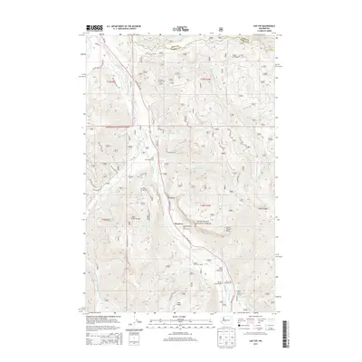
2014 Map of Sun Top
USGS Topo · Published 2014About this map
The Dalles and the high-elevation terrain of Snoqualmie National Forest define this landscape along the King and Pierce county line. The corridor is anchored by the White River, where recreation and institutional sites like Camp Sheppard Boy Scout Camp, Seattle University Lodge, and Alta Crystal Chalets sit near the base of the mountain slopes. The transport network is dominated by the Chinook Pass Hwy and State Hwy 410, which provide access to the The Dalles Recreation Area and the remote Ranger Creek Airport. Prominent peaks and ridges, including Sun Top with its Sun Top Viewpoint and the long expanse of Dalles Ridge, overlook a drainage system of creeks like Huckleberry Creek and Skookum Cr. This 2014 survey documents the modern layout of these alpine recreation and forest service lands before more recent environmental changes.
Find a feature on this map
33 named features on this map. Tap any name to fly to it.
Don’t see what you’re looking for? This feature index may not catch every label — zoom into the map to look around manually.
Map Details
Editions of this 2014 Sun Top Map
This is the sole edition of this map. No revisions or reprints were ever made.
Other maps of this area

1901 · Snoqualmie Pass
USGS Topo · 1:125,000

1902 · Mount Aix
USGS Topo · 1:125,000

1903 · Snoqualmie
USGS Topo · 1:125,000

1904 · Mt Aix
USGS Topo · 1:125,000

1913 · Cedar Lake
USGS Topo · 1:125,000

1924 · Mt Rainier
USGS Topo · 1:96,000

1928 · Mt Rainier
USGS Topo · 1:125,000

1950 · Yakima
USGS Topo · 1:250,000

1956 · Greenwater
USGS Topo · 1:62,500

1957 · Wenatchee
USGS Topo · 1:250,000