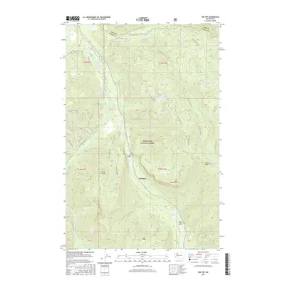
2017 Map of Sun Top
USGS Topo · Published 2017About this map
Snoqualmie National Forest dominates this mountain landscape along the border of King and Pierce counties. The deep valley of the White River serves as a primary corridor for transportation and small settlements like The Dalles and Snoquera. High-elevation landmarks such as Sun Top and Little Ranger Peak define the local topography, which is carved by numerous drainages including Huckleberry Cr and Buck Cr. The presence of the Ranger Creek Airport near the riverbank highlights the region's specialized infrastructure for forest management and backcountry access. This 2017 survey details an extensive network of Forest Service roads, such as Nat For Dev Rd 7160, providing a modern record of the access points to Dalles Ridge and remote water bodies like Dalles Lakes.
Find a feature on this map
66 named features on this map. Tap any name to fly to it.
Don’t see what you’re looking for? This feature index may not catch every label — zoom into the map to look around manually.
Map Details
Editions of this 2017 Sun Top Map
This is the sole edition of this map. No revisions or reprints were ever made.
Other maps of this area

1901 · Snoqualmie Pass
USGS Topo · 1:125,000

1902 · Mount Aix
USGS Topo · 1:125,000

1903 · Snoqualmie
USGS Topo · 1:125,000

1904 · Mt Aix
USGS Topo · 1:125,000

1913 · Cedar Lake
USGS Topo · 1:125,000

1924 · Mt Rainier
USGS Topo · 1:96,000

1928 · Mt Rainier
USGS Topo · 1:125,000

1950 · Yakima
USGS Topo · 1:250,000

1956 · Greenwater
USGS Topo · 1:62,500

1957 · Wenatchee
USGS Topo · 1:250,000