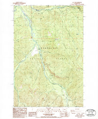
1986 Map of Sun Top
USGS Topo · Published 1986About this map
Snoqualmie National Forest dominates this mid-1980s landscape, where the confluence of the White River and Greenwater River marks the northern boundary between King and Pierce counties. The map details a high-elevation backcountry infrastructure centered around the White River valley, featuring The Dalles Campground and the specialized Ranger Creek Landing Strip. To the west, Huckleberry Ridge and the summit of Sun Top rise sharply, the latter distinguished by the Sun Top LO lookout station.
Find a feature on this map
37 named features on this map. Tap any name to fly to it.
Don’t see what you’re looking for? This feature index may not catch every label — zoom into the map to look around manually.
Map Details
Editions of this 1986 Sun Top Map
This is the sole edition of this map. No revisions or reprints were ever made.
Other maps of this area

1901 · Snoqualmie Pass
USGS Topo · 1:125,000

1902 · Mount Aix
USGS Topo · 1:125,000

1903 · Snoqualmie
USGS Topo · 1:125,000

1904 · Mt Aix
USGS Topo · 1:125,000

1913 · Cedar Lake
USGS Topo · 1:125,000

1924 · Mt Rainier
USGS Topo · 1:96,000

1928 · Mt Rainier
USGS Topo · 1:125,000

1950 · Yakima
USGS Topo · 1:250,000

1956 · Greenwater
USGS Topo · 1:62,500

1957 · Wenatchee
USGS Topo · 1:250,000