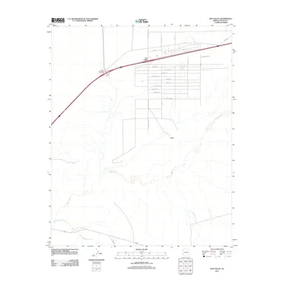
2011 Map of Sun Valley
USGS Topo · Published 2011About this map
The confluence of the Puerco River and the Little Colorado River defines the southern reach of this arid landscape in Navajo County. The settlement of Sun Valley is the primary hub of activity, organized by an extensive grid of named roads including Ramada Rd, Stampede Rd, and Sundance Rd that suggest a planned residential or ranching community layout. North of the river, the Keams Canyon Road Interchange provides a major transit point connecting the local grid to broader regional routes. Near the center of the map, the smaller settlement of Arntz sits isolated from the main Sun Valley grid, while the road to Woodruff exits to the south. This 2011 survey captures a moment of modern development where desert topography meets a formal street network, reflecting the gradual expansion of infrastructure across the High Desert plateau.
Find a feature on this map
28 named features on this map. Tap any name to fly to it.
Don’t see what you’re looking for? This feature index may not catch every label — zoom into the map to look around manually.
Map Details
Editions of this 2011 Sun Valley Map
This is the sole edition of this map. No revisions or reprints were ever made.
Other maps of this area

1883 · Tusayan
USGS Topo · 1:250,000

1886 · St Johns
USGS Topo · 1:250,000

1886 · Tusayan
USGS Topo · 1:250,000

1886 · Fort Defiance
USGS Topo · 1:250,000

1886 · Holbrook
USGS Topo · 1:250,000

1892 · Fort Defiance
USGS Topo · 1:250,000

1892 · St Johns
USGS Topo · 1:250,000

1893 · Holbrook
USGS Topo · 1:250,000

1912 · Petrified Forest
USGS Topo · 1:62,500

1947 · Flagstaff
USGS Topo · 1:250,000