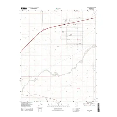
2014 Map of Sun Valley
USGS Topo · Published 2014About this map
Sun Valley and Arntz occupy the high desert landscape of Navajo County, positioned near the significant confluence of regional waterways. The Little Colorado River cuts across the southwestern corner, while the Puerco River carves a winding path through the center of the quadrangle. This 2014 survey captures a residential layout characterized by a dense grid of named streets in the northeast, featuring evocative names like Stagecoach Rd, Stampede Rd, and Starlight Rd. These naming conventions suggest a deliberate community design centered around Western themes. Transportation in the area is defined by the intersection of major thoroughfares and rural routes, including Us-180 and N Old Woodruff Rd, which connect these small settlements to the broader Arizona landscape. The presence of Puerco Tank indicates the vital importance of water management in this arid environment.
Find a feature on this map
37 named features on this map. Tap any name to fly to it.
Don’t see what you’re looking for? This feature index may not catch every label — zoom into the map to look around manually.
Map Details
Editions of this 2014 Sun Valley Map
This is the sole edition of this map. No revisions or reprints were ever made.
Other maps of this area

1883 · Tusayan
USGS Topo · 1:250,000

1886 · St Johns
USGS Topo · 1:250,000

1886 · Tusayan
USGS Topo · 1:250,000

1886 · Fort Defiance
USGS Topo · 1:250,000

1886 · Holbrook
USGS Topo · 1:250,000

1892 · Fort Defiance
USGS Topo · 1:250,000

1892 · St Johns
USGS Topo · 1:250,000

1893 · Holbrook
USGS Topo · 1:250,000

1912 · Petrified Forest
USGS Topo · 1:62,500

1947 · Flagstaff
USGS Topo · 1:250,000