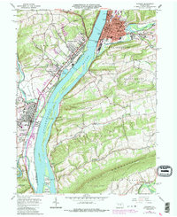
1965 Map of Sunbury
USGS Topo · Published 1987About this map
The Susquehanna River dominates this mid-1960s landscape, its channel punctuated by a chain of large river islands including Byers Island, Cherry Island, and Kinney Island. On the eastern bank, the city of Sunbury serves as a dense urban core, while the western side shows the growth of Shamokin Dam and Hummels Wharf along the corridor leading toward Selinsgrove Junction. The map reveals a community defined by its educational and recreational institutions, from the campus of Susquehanna University to the Rolling Green Amusement Park. Significant infrastructure such as the Penn Valley Airport and a series of Conrail rail lines underscore the region's role as a transportation hub. Beyond the riverfront, the terrain climbs toward Little Mahanoy Mountain, where smaller rural settlements like Patricksburg and Asherton are marked by landmark local institutions like St Peters Ch and Augusta Ch.
Find a feature on this map
87 named features on this map. Tap any name to fly to it.
Don’t see what you’re looking for? This feature index may not catch every label — zoom into the map to look around manually.
Map Details
Editions of this 1965 Sunbury Map
4 editions found
Other maps of this area

1892 · Lykens
USGS Topo · 1:62,500

1892 · Shamokin
USGS Topo · 1:62,500

1893 · Sunbury
USGS Topo · 1:62,500

1893 · Lykens
USGS Topo · 1:62,500

1893 · Shamokin
USGS Topo · 1:62,500

1893 · Millersburg
USGS Topo · 1:62,500

1943 · Millersburg
USGS Topo · 1:62,500

1943 · Lykens
USGS Topo · 1:62,500

1943 · Shamokin
USGS Topo · 1:62,500

1943 · Sunbury
USGS Topo · 1:62,500