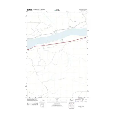
2011 Map of Sundale
USGS Topo · Published 2011About this map
The Columbia River dominates this stretch of the Washington-Oregon border, defining a landscape of deep canyons and transport corridors. The small settlement of Sundale sits on the northern bank, serves as a focal point where local routes like Hanan Dr and Sundale Rd meet the river's edge. Opposite the water, the settlement of Blalock and the rugged cuts of Blalock Canyon illustrate the topographical challenges of the Columbia River Gorge.
Find a feature on this map
14 named features on this map. Tap any name to fly to it.
Don’t see what you’re looking for? This feature index may not catch every label — zoom into the map to look around manually.
Map Details
Editions of this 2011 Sundale Map
This is the sole edition of this map. No revisions or reprints were ever made.
Other maps of this area

1916 · Arlington
USGS Topo · 1:125,000

1953 · The Dalles
USGS Topo · 1:250,000

1956 · The Dalles
USGS Topo · 1:250,000

1957 · The Dalles
USGS Topo · 1:250,000

1962 · Wood Gulch
USGS Topo · 1:24,000

1964 · Turner Butte
USGS Topo · 1:24,000

1964 · Shutler Flat
USGS Topo · 1:24,000

1964 · Mc Donald
USGS Topo · 1:24,000

1965 · Goodnoe Hills
USGS Topo · 1:24,000
1965 · Dot
USGS Topo · 1:24,000