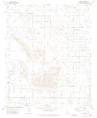
1972 Map of Sunfair
USGS Topo · Published 1975About this map
Copper Mountain dominates this arid High Desert landscape, separating the developing residential tracts of Sunfair Heights and Desert Heights from the dry expanse of Coyote Lake. In the early 1970s, this region of San Bernardino County was characterized by a grid of dirt roads and sprawling desert subdivisions, punctuated by essential water infrastructure like Coyote Well and numerous private wells. The presence of the Hi Desert Airport and the KQYN Antenna reflects the mid-century modernization of this remote Mojave environment.
Find a feature on this map
39 named features on this map. Tap any name to fly to it.
Don’t see what you’re looking for? This feature index may not catch every label — zoom into the map to look around manually.
Map Details
Editions of this 1972 Sunfair Map
2 editions found
Other maps of this area

1953 · San Bernardino
USGS Topo · 1:250,000

1955 · Goat Mountain
USGS Topo · 1:24,000

1955 · Deadman Lake SE
USGS Topo · 1:24,000

1955 · Deadman Lake SW
USGS Topo · 1:24,000

1955 · Twentynine Palms
USGS Topo · 1:24,000

1955 · Twentynine Palms
USGS Topo · 1:62,500

1955 · Emerson Lake
USGS Topo · 1:62,500
1955 · Deadman Lake
USGS Topo · 1:62,500

1955 · Joshua Tree
USGS Topo · 1:62,500

1956 · San Bernardino
USGS Topo · 1:250,000