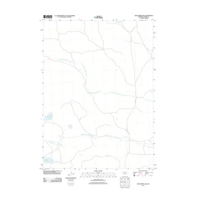
2011 Map of Sunflower Lake
USGS Topo · Published 2011About this map
The North Branch Middle Loup River and Middle Branch Middle Loup River wind through this section of the Nebraska Sandhills, defining a landscape of sparse water and intermittent drainage. This 2011 survey by the U.S. Geological Survey captures a region of Cherry County dominated by its namesake Sunflower Lake and the smaller Krumpf Lake to the southwest. The presence of N Whitman Rd indicates the primary north-south artery serving the few isolated ranching properties in this part of the state. Unlike more developed agricultural regions, the map highlights the unique hydrology of the Loup River system, where branches weave through sandy depressions and natural basins typical of north-central Nebraska.
Find a feature on this map
5 named features on this map. Tap any name to fly to it.
Don’t see what you’re looking for? This feature index may not catch every label — zoom into the map to look around manually.
Map Details
Editions of this 2011 Sunflower Lake Map
This is the sole edition of this map. No revisions or reprints were ever made.
Other maps of this area

1948 · Whitman
USGS Topo · 1:62,500

1949 · Steverson Lake
USGS Topo · 1:62,500

1950 · Whitman
USGS Topo · 1:62,500

1950 · Hire
USGS Topo · 1:62,500

1950 · Wolf Lake
USGS Topo · 1:62,500

1951 · Steverson Lake
USGS Topo · 1:62,500

1951 · Wolf Lake
USGS Topo · 1:62,500

1957 · Valentine
USGS Topo · 1:250,000

1959 · Valentine
USGS Topo · 1:250,000

1985 · Mullen
USGS Topo · 1:100,000