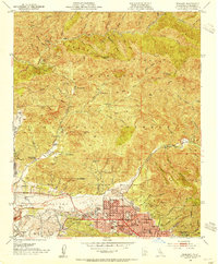
1953 Map of Sunland
USGS Topo · Published 1954About this map
The San Gabriel Mountains dominate this 1953 landscape, where the rugged southern slopes meet the developing communities of the Tujunga Valley. Significant residential and institutional growth is evident in Sunland and Tujunga, characterized by landmarks like the Hillcrest Sanitarium and Verdugo Hills High School. North of the City Boundary, the terrain transitions into the Los Angeles National Forest, a region defined by steep canyons such as Big Tujunga Canyon and Pacoima Canyon. This area reveals a legacy of mountain life and early industry, from the Mining Mill (Ruins) near Buck Canyon to a series of remote outposts like Dutch Louie Camp and Paradise Ranch. The map also captures several family-named properties, including Chaffin Ranch and Herreres Ranch, positioned along the seasonal washes and creek beds that carved the alluvial landscape before the suburban expansion of the late 20th century.
Find a feature on this map
74 named features on this map. Tap any name to fly to it.
Don’t see what you’re looking for? This feature index may not catch every label — zoom into the map to look around manually.
Map Details
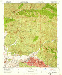
Editions of this 1953 Sunland Map
2 editions found
Other maps of this area

1894 · Los Angeles
USGS Topo · 1:62,500

1896 · Pasadena
USGS Topo · 1:62,500

1896 · Santa Monica
USGS Topo · 1:62,500

1898 · Santa Monica
USGS Topo · 1:62,500

1900 · Pasadena
USGS Topo · 1:62,500

1900 · Tujunga
USGS Topo · 1:62,500

1900 · Los Angeles
USGS Topo · 1:62,500

1900 · Fernando
USGS Topo · 1:62,500

1901 · Southern California Sheet No. 1
USGS Topo · 1:250,000

1902 · Santa Monica
USGS Topo · 1:62,500