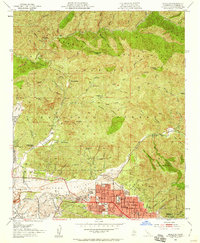
1953 Map of Sunland
USGS Topo · Published 1959About this map
The San Gabriel Mountains dominate the northern landscape of this mid-century survey, where the rugged peaks and canyons of the Angeles National Forest meet the expanding residential districts of the Tujunga Valley. The area is characterized by a transition from the wild terrain of Big Tujunga Canyon and Mendenhall Peak to the developed blocks of Sunland and Tujunga. Local industry and social history are evidenced by the presence of the Mining Mill (Ruins) in the hills and numerous agricultural operations like Chaffin Ranch and Watts Ranch. Educational and community hubs such as Verdugo Hills High Sch and Our Lady of Lourdes Sch are established in the valley floor, while recreation is represented by Sunland Park and the Camp Bill Lane (BSA) scout camp near the Los Angeles City Boundary. The map also captures infrastructure critical to the region's development, including the Hansen Flood Control Basin and Foothill Blvd.
Find a feature on this map
84 named features on this map. Tap any name to fly to it.
Don’t see what you’re looking for? This feature index may not catch every label — zoom into the map to look around manually.
Map Details
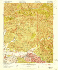
Editions of this 1953 Sunland Map
2 editions found
Other maps of this area

1894 · Los Angeles
USGS Topo · 1:62,500

1896 · Pasadena
USGS Topo · 1:62,500

1896 · Santa Monica
USGS Topo · 1:62,500

1898 · Santa Monica
USGS Topo · 1:62,500

1900 · Pasadena
USGS Topo · 1:62,500

1900 · Tujunga
USGS Topo · 1:62,500

1900 · Los Angeles
USGS Topo · 1:62,500

1900 · Fernando
USGS Topo · 1:62,500

1901 · Southern California Sheet No. 1
USGS Topo · 1:250,000

1902 · Santa Monica
USGS Topo · 1:62,500