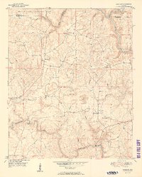
1951 Map of Sunlight
USGS Topo · Published 1951About this map
The William B Bankhead National Forest defines the northern reaches of this landscape, where the Sipsey Fork and its tributaries like Duncan Creek and Raccoon Branch carve through the terrain. This mid-century view shows a rural economy in transition, where small agricultural communities like Marylee and Sunlight exist alongside industrial Strip Mine operations. The network of country churches, including Philadelphia Ch and Mt Olive Ch, provides a clear view of the social geography of the era, marking the centers of local life for families in northern Walker County.
Find a feature on this map
33 named features on this map. Tap any name to fly to it.
Don’t see what you’re looking for? This feature index may not catch every label — zoom into the map to look around manually.
Map Details
Editions of this 1951 Sunlight Map
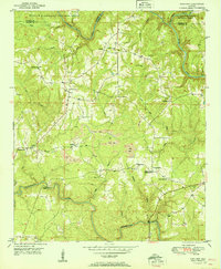
2 editions found
Other maps of this area

1893 · Jasper
USGS Topo · 1:125,000

1949 · Cordova
USGS Topo · 1:24,000

1949 · Sipsey
USGS Topo · 1:24,000

1949 · Cold Springs
USGS Topo · 1:24,000

1949 · Jasper
USGS Topo · 1:24,000

1949 · Manchester
USGS Topo · 1:24,000

1949 · Sunlight
USGS Topo · 1:24,000

1950 · Manchester
USGS Topo · 1:24,000

1951 · Jasper
USGS Topo · 1:24,000

1951 · Cold Springs
USGS Topo · 1:24,000