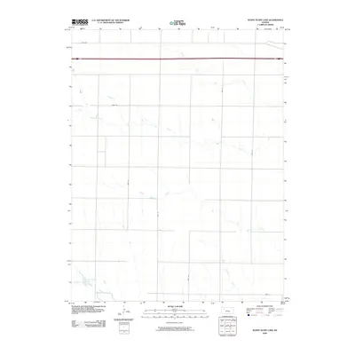
2009 Map of Sunny Slope Lake
USGS Topo · Published 2009About this map
Big Creek and its major tributary, North Fork Big Creek, dominate this central Gove County landscape, carving through the high plains. The drainage patterns of East Spring Creek and West Spring Creek illustrate the hydrologic network essential to this Kansas region. In the southwestern corner, Sunny Slope Lake serves as a distinct landmark alongside the North Branch Hackberry Cr. This 2009 survey highlights a rural grid defined by county roads such as Gove BB and Gove 40, while the northern edge is anchored by the corridor of I-70 and Highway 40. The map documents a land primarily shaped by watercourses and the section-line roads that facilitate travel across the wide prairie.
Find a feature on this map
16 named features on this map. Tap any name to fly to it.
Don’t see what you’re looking for? This feature index may not catch every label — zoom into the map to look around manually.
Map Details
Editions of this 2009 Sunny Slope Lake Map
This is the sole edition of this map. No revisions or reprints were ever made.
Other maps of this area

1954 · Goodland
USGS Topo · 1:250,000

1955 · Scott City
USGS Topo · 1:250,000

1956 · Goodland
USGS Topo · 1:250,000

1957 · Goodland
USGS Topo · 1:250,000

1958 · Scott City
USGS Topo · 1:250,000

1972 · Orion NE
USGS Topo · 1:24,000

1972 · Gove
USGS Topo · 1:24,000

1972 · Orion
USGS Topo · 1:24,000

1979 · Midway Draw West
USGS Topo · 1:24,000
1979 · Grainfield
USGS Topo · 1:24,000