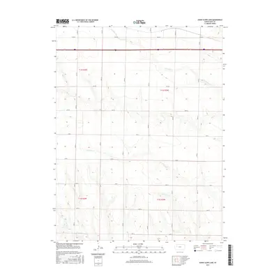
2015 Map of Sunny Slope Lake
USGS Topo · Published 2015About this map
N Fork Big Cr and Big Cr carve a network of drainage patterns across this section of Gove County, where the High Plains landscape is defined by its deep creek beds and vast agricultural partitions. This 2015 survey reveals a terrain meticulously organized by a grid of rural routes, including Gove DD and Co Rd 32, which segment the land into townships like t11s r30w and t11s r29w. The hydrology of the region is further detailed by the presence of E Spring Cr and W Spring Cr, which serve as vital markers for understanding the local watershed. At the southern edge, the headwaters of N Br Hackberry Cr appear, illustrating how water management and natural topography dictate the placement of local infrastructure and property lines in this western Kansas territory.
Find a feature on this map
19 named features on this map. Tap any name to fly to it.
Don’t see what you’re looking for? This feature index may not catch every label — zoom into the map to look around manually.
Map Details
Editions of this 2015 Sunny Slope Lake Map
This is the sole edition of this map. No revisions or reprints were ever made.
Other maps of this area

1954 · Goodland
USGS Topo · 1:250,000

1955 · Scott City
USGS Topo · 1:250,000

1956 · Goodland
USGS Topo · 1:250,000

1957 · Goodland
USGS Topo · 1:250,000

1958 · Scott City
USGS Topo · 1:250,000

1972 · Orion NE
USGS Topo · 1:24,000

1972 · Gove
USGS Topo · 1:24,000

1972 · Orion
USGS Topo · 1:24,000

1979 · Midway Draw West
USGS Topo · 1:24,000
1979 · Grainfield
USGS Topo · 1:24,000